Plik:Austrian Empire (1815).svg

Wielkość pliku podglądu PNG dla pliku SVG: 450 x 456 pikselōw Inksze rozdzielczości: 237 x 240 pikselōw | 474 x 480 pikselōw | 758 x 768 pikselōw | 1011 x 1024 pikselōw | 2021 x 2048 pikselōw.
Ôryginalny zbiōr (Zbiōr SVG, nōminalnie 450 × 456 pikselōw, srogość zbioru: 691 KB)
Ôpis


.svg)
.svg)
.svg)
.svg)
.svg)


.svg)
.svg)
.svg)


.png)
.png)


.svg)


.svg)

.svg)


.svg)
.svg)
.svg)
.svg)


.svg)
.png)


.svg)


.svg)
.svg)


.svg)


.svg)


.svg)
.svg)
.svg)
.svg)
.svg)
.svg)
.svg)
.svg)
_cropped.svg)
.svg)
.svg)
.svg)
.svg)
.svg)
.svg)
.svg)
.svg)
.svg)
.svg)
.svg)
.svg)
.svg)
.svg)
.svg)
.svg)
.svg)
.svg)
.svg)
.svg)
.svg)
.svg)
.svg)
.svg)
.svg)
.svg)
.svg)
.svg)
.svg)
.svg)
.svg)
.svg)
.svg)
.svg)
.svg)
.svg)
.svg)
.svg)
.svg)
.svg)
.svg)
.svg)
.svg)
.svg)
.svg)
Gyszichta zbioru
Kliknij w datã/czas, żeby ôbejzdrzeć zbiōr, jak wtynczŏs wyglōndoł.
| Data i czas | Miniatura | Wymiary | Używŏcz | Kōmyntŏrz | |
|---|---|---|---|---|---|
| terŏźnŏ | 11:58, 16 kwi 2019 | | 450 × 456 (691 KB) | TRAJAN 117 | +++ |
| 23:20, 12 siy 2013 |  | 450 × 456 (654 KB) | TRAJAN 117 | Update | |
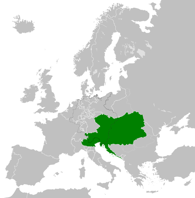
| 07:47, 12 siy 2013 |  | 450 × 456 (1 MB) | TRAJAN 117 | {{Information |Description ={{en|1=The Austrian Empire in 1815.}} |Source ={{own}} {{AttribSVG|Blank map of Europe 1815.svg|Alphathon}} |Author =TRAJAN 117 {{created with Inkscape}} |Date =2013-08-12 |Pe... |
Użycie zbioru
Ta strōna używŏ tego zbioru:
Globalne użycie zbioru
Tyn zbiōr je używany tyż we inkszych projektach wiki:
- Użycie we af.wikipedia.org
- Użycie we ast.wikipedia.org
- Użycie we azb.wikipedia.org
- Użycie we ba.wikipedia.org
- Użycie we bg.wikipedia.org
- Użycie we br.wikipedia.org
- Użycie we ce.wikipedia.org
- Użycie we cs.wikipedia.org
- Użycie we cy.wikipedia.org
- Użycie we de.wikipedia.org
- Użycie we el.wikipedia.org
- Użycie we en.wikipedia.org
- Użycie we es.wikipedia.org
- Użycie we fi.wikipedia.org
- Użycie we frr.wikipedia.org
- Użycie we fr.wikipedia.org
- Użycie we ga.wikipedia.org
- Użycie we gd.wikipedia.org
- Użycie we gl.wikipedia.org
- Użycie we he.wikipedia.org
- Użycie we hi.wikipedia.org
- Użycie we hr.wikipedia.org
- Użycie we hy.wikipedia.org
- Użycie we id.wikipedia.org
- Użycie we id.wikibooks.org
- Użycie we incubator.wikimedia.org
- Użycie we is.wikipedia.org
- Użycie we it.wikipedia.org
- Użycie we jam.wikipedia.org
- Użycie we ja.wikipedia.org
- Użycie we ka.wikipedia.org
- Użycie we km.wikipedia.org
- Użycie we ko.wikipedia.org
- Użycie we ky.wikipedia.org
- Użycie we lmo.wikipedia.org
- Użycie we lt.wikipedia.org
- Użycie we lv.wikipedia.org
- Użycie we mk.wikipedia.org
- Użycie we mn.wikipedia.org
- Użycie we nap.wikipedia.org
- Użycie we nl.wikipedia.org
Pokŏż listã globalnego użyciŏ tego zbioru.
.svg)
.svg)