Plik:Kazakhstan adm location map.svg

Ôryginalny zbiōr (Zbiōr SVG, nōminalnie 1984 × 1134 pikselōw, srogość zbioru: 562 KB)
Ôpis
| Ôpis |
Deutsch: Positionskarte von Kasachstan
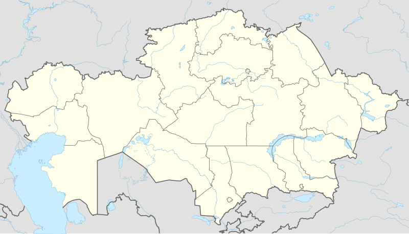
English: Location map of Kazakhstan
|
||||||||||||
| Data | |||||||||||||
| Zdrzōdło |
Praca własna przy użyciu:
|
||||||||||||
| Autōr | NordNordWest | ||||||||||||
| Inksze wersyje |
|
||||||||||||
_location_map.svg)

|
Ta mapa została stworzona lub ulepszona w niemieckiej Kartenwerkstatt (Pracowni Kartograficznej). I Ty możesz zaproponować inne mapy do ulepszenia.
|
Licyncyjŏ
Usage of this file with:

explanatory notes: Legally binding is only the full legalcode. For a free usage I recommend to respect the following licence conditions:
1. Provide my name as given above: NordNordWest,
2. a copy of, or the URI for, the applicable license: https://creativecommons.org/licenses/by-sa/3.0/de/legalcode,
3. the title of the work,
4. in the case of an adaptation, a credit identifying the use of the work in the adaptation.
This license and the rights granted hereunder will terminate automatically upon any breach by you of the terms of this license. Any of the above conditions can be waived if you get permission from the copyright holder. If you have questions or wish differing conditions, please contact me through nnwest or my discussion page ![]() t-online.de
t-online.de
- Idzie:
- udostympniać – kopiować, rozkludzać i przekazować dzieło
- modyfikować – adaptować dzieło
- Pod tymi warōnkami:
- uznanie autorstwa – Musisz ôkryślić autorstwo, podać link do licyncyje, i skŏzać, czy dzieło było zmiyniōne. Możesz to zrobić kożdym usōndnym spusobym, ale niy tak, żeby sugerować, że posiedziciel licyncyje spiyrŏ Ciebie abo Twoje użycie dzieła.
- trzim licyncyjõ – Jeźli zmiyniŏsz abo budujesz na tyj materyji, musisz swoje dzieło rozkludzać na takij samyj abo zgodliwyj licyncyji, jak we ôryginale.

Gyszichta zbioru
Kliknij w datã/czas, żeby ôbejzdrzeć zbiōr, jak wtynczŏs wyglōndoł.
| Data i czas | Miniatura | Wymiary | Używŏcz | Kōmyntŏrz | |
|---|---|---|---|---|---|
| terŏźnŏ | 16:16, 4 paź 2022 | | 1984 × 1134 (562 KB) | NordNordWest | upd 2022 |
| 21:45, 21 lut 2022 |  | 1984 × 1134 (554 KB) | NordNordWest | corr | |
| 23:41, 25 czy 2018 |  | 1984 × 1134 (619 KB) | NordNordWest | corr | |
| 17:48, 26 wrz 2014 |  | 1984 × 1134 (618 KB) | NordNordWest | == {{int:filedesc}} == {{Information |Description= {{de|1=Positionskarte von Kasachstan}} {{en|1=Location map of Kazakhstan}} {{Location map series N |stretching=150 |top=56 |bottom=40 |left=46 |right=88 }} |Source={{Own using}} * United States Nationa... |
Użycie zbioru
Te strōny używajōm tego zbioru:
Globalne użycie zbioru
Tyn zbiōr je używany tyż we inkszych projektach wiki:
- Użycie we af.wikipedia.org
- Użycie we an.wikipedia.org
- Użycie we ar.wikipedia.org
- Użycie we ast.wikipedia.org
- Użycie we azb.wikipedia.org
- Użycie we az.wikipedia.org
Pokŏż listã globalnego użyciŏ tego zbioru.