Plik:Luxembourg adm location map.svg

Ôryginalny zbiōr (Zbiōr SVG, nōminalnie 746 × 1032 pikselōw, srogość zbioru: 474 KB)
Ôpis
| Ôpis |
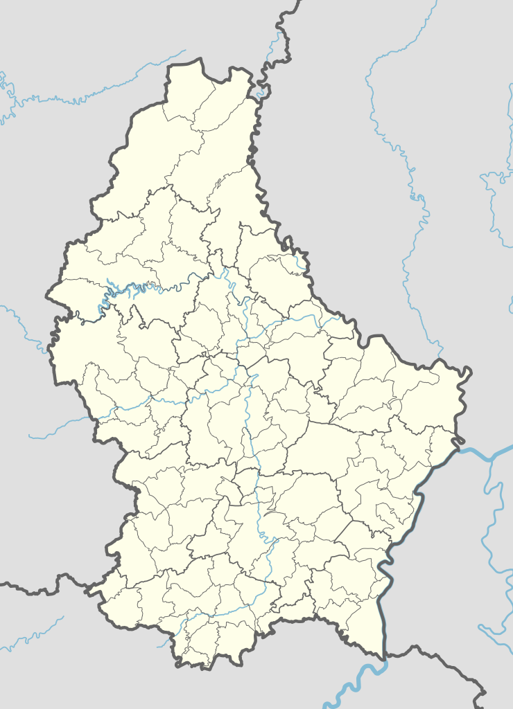
Deutsch: Positionskarte von Luxemburg
English: Location map of Luxembourg
|
||||||||||||
| Data | |||||||||||||
| Zdrzōdło |
Praca własna przy użyciu:
|
||||||||||||
| Autōr | NordNordWest | ||||||||||||
| Inksze wersyje |
|
||||||||||||
_location_map.svg)
_location_map.svg)
Licyncyjŏ
Usage of this file with:

explanatory notes: Legally binding is only the full legalcode. For a free usage I recommend to respect the following licence conditions:
1. Provide my name as given above: NordNordWest,
2. a copy of, or the URI for, the applicable license: https://creativecommons.org/licenses/by-sa/3.0/de/legalcode,
3. the title of the work,
4. in the case of an adaptation, a credit identifying the use of the work in the adaptation.
This license and the rights granted hereunder will terminate automatically upon any breach by you of the terms of this license. Any of the above conditions can be waived if you get permission from the copyright holder. If you have questions or wish differing conditions, please contact me through nnwest or my discussion page ![]() t-online.de
t-online.de
- Idzie:
- udostympniać – kopiować, rozkludzać i przekazować dzieło
- modyfikować – adaptować dzieło
- Pod tymi warōnkami:
- uznanie autorstwa – Musisz ôkryślić autorstwo, podać link do licyncyje, i skŏzać, czy dzieło było zmiyniōne. Możesz to zrobić kożdym usōndnym spusobym, ale niy tak, żeby sugerować, że posiedziciel licyncyje spiyrŏ Ciebie abo Twoje użycie dzieła.
- trzim licyncyjõ – Jeźli zmiyniŏsz abo budujesz na tyj materyji, musisz swoje dzieło rozkludzać na takij samyj abo zgodliwyj licyncyji, jak we ôryginale.

Ta grafika została oceniona wg kryteriów dla grafik wysokiej jakości i jest uważana za grafikę wysokiej jakości.
|
Gyszichta zbioru
Kliknij w datã/czas, żeby ôbejzdrzeć zbiōr, jak wtynczŏs wyglōndoł.
| Data i czas | Miniatura | Wymiary | Używŏcz | Kōmyntŏrz | |
|---|---|---|---|---|---|
| terŏźnŏ | 18:09, 10 wrz 2023 | | 746 × 1032 (474 KB) | NordNordWest | upd 2023 |
| 12:28, 8 sty 2018 |  | 746 × 1032 (476 KB) | NordNordWest | upd | |
| 11:06, 2 lis 2015 |  | 746 × 1032 (481 KB) | NordNordWest | corr | |
| 19:20, 1 lis 2015 |  | 746 × 1032 (481 KB) | NordNordWest | == {{int:filedesc}} == {{Information |Description= {{de|1=Positionskarte von Luxemburg}} {{en|1=Location map of Luxembourg}} {{Location map series N |stretching= – |top=50.25 |bottom=49.4 |left=5.65 |right=6.6 }} |Source={{Own using}} * United States... |
Użycie zbioru
Żŏdnŏ strōna niy używŏ tego zbioru.
Globalne użycie zbioru
Tyn zbiōr je używany tyż we inkszych projektach wiki:
- Użycie we af.wikipedia.org
- Użycie we an.wikipedia.org
- Użycie we ar.wikipedia.org
- Użycie we ast.wikipedia.org
- Tribunal de Xusticia de la Xunión Europea
- Luxemburgu (ciudá)
- Módulu:Mapa de llocalización/datos/Luxemburgu
- Bancu Européu d'Inversiones
- Hôtel de la Chambre
- Castiellu de Berg
- Palaciu Gran Ducal de Luxemburgu
- Módulu:Mapa de llocalización/datos/Luxemburgu/usu
- Aeropuertu de Luxemburgu Findel
- Aeródromu de Noertrange
- Użycie we az.wikipedia.org
- Użycie we bn.wikipedia.org
- Użycie we ca.wikipedia.org
- Usuari:PereBot/cobertura/Luxemburg/ranking
- Usuari:PereBot/cobertura/Luxemburg/ca
- Usuari:PereBot/cobertura/Luxemburg/de
- Usuari:PereBot/cobertura/Luxemburg/en
- Usuari:PereBot/cobertura/Luxemburg/es
- Usuari:PereBot/cobertura/Luxemburg/fr
- Usuari:PereBot/cobertura/Luxemburg/it
- Usuari:PereBot/cobertura/Luxemburg/lb
- Usuari:PereBot/cobertura/Luxemburg/nl
- Usuari:PereBot/cobertura/Luxemburg/wa
- Mòdul:Location map/data/Luxemburg
- Mòdul:Location map/data/Luxemburg/ús
- Użycie we crh.wikipedia.org
- Użycie we de.wikipedia.org
Pokŏż listã globalnego użyciŏ tego zbioru.