Plik:Sandusky Ohio aerial view.jpg
Srogość tego podglōndu: 800 x 533 pikselōw. Inksze rozdzielczości: 320 x 213 pikselōw | 640 x 426 pikselōw | 1024 x 682 pikselōw | 1500 x 999 pikselōw.
Ôryginalny zbiōr (1500 × 999 pikselōw, srogość zbioru: 761 KB, zorta MIME: image/jpeg)
| Ôpis |
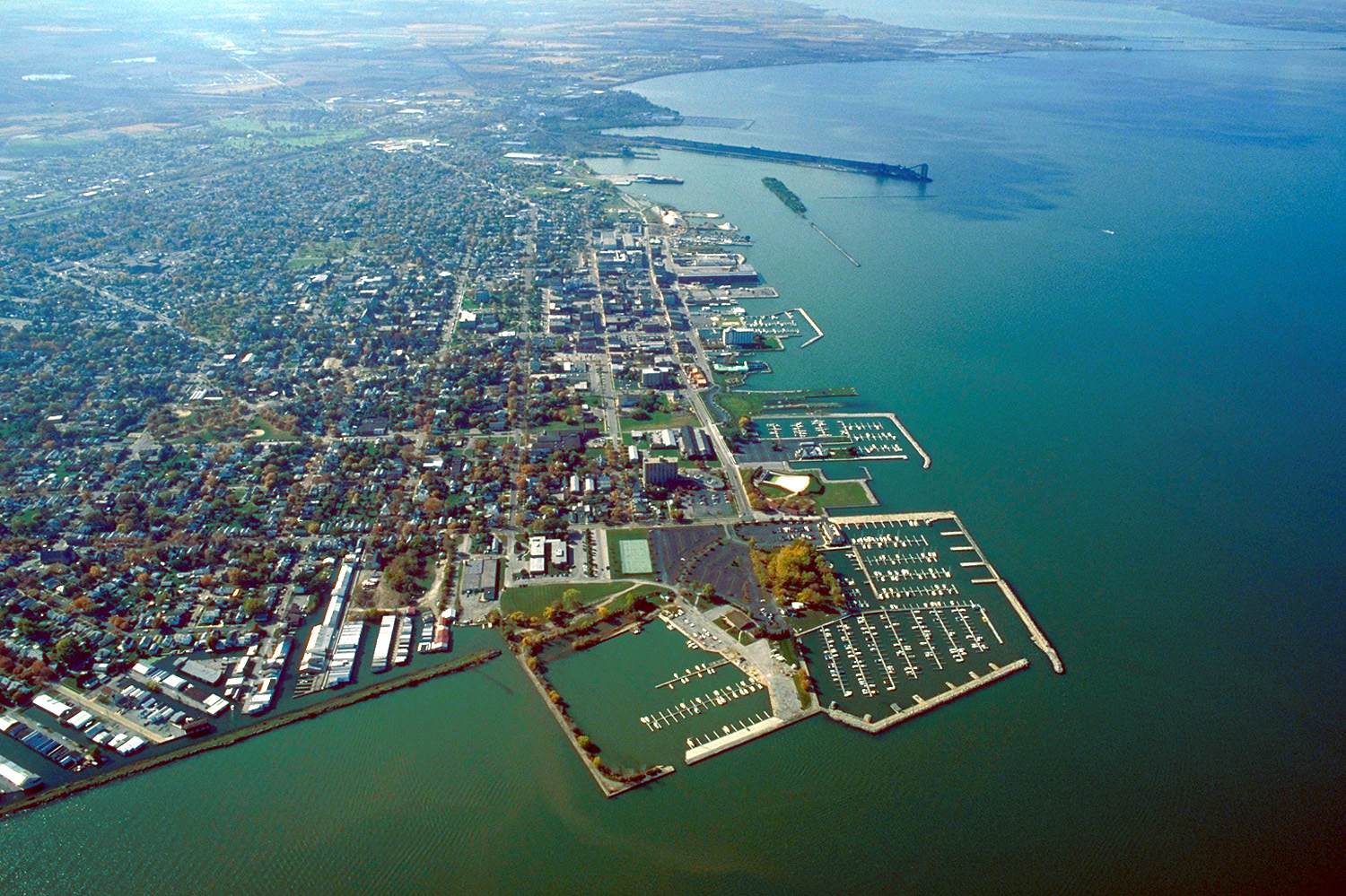
English: Aerial view of Sandusky, Ohio, USA. The view is to the west-southwest along the waterfront on Sandusky Bay, a large inlet and bay off of Lake Erie. |
|||
| Data | ||||
| Zdrzōdło |
U.S. Army Corps of Engineers Digital Visual Library Image page Image description page Digital Visual Library home page |
|||
| Autōr | Ken Winters, U.S. Army Corps of Engineers | |||
| Przizwolynie (Użycie tego zbioru) |
|
|||
| Miejsce | Sandusky, Ohio, USA |
| Pozycja fotografa | | To i inne zdjęcia na: OpenStreetMap |
|---|
Gyszichta zbioru
Kliknij w datã/czas, żeby ôbejzdrzeć zbiōr, jak wtynczŏs wyglōndoł.
| Data i czas | Miniatura | Wymiary | Używŏcz | Kōmyntŏrz | |
|---|---|---|---|---|---|
| terŏźnŏ | 23:44, 24 mar 2007 | | 1500 × 999 (761 KB) | DanMS | {{Information | Description = {{en|Aerial view of Sandusky, Ohio, USA. The view is to the west-southwest along the waterfront on Sandusky Bay, a large inlet and bay off of Lake Erie.}} | Source = U.S. Army Corps of Engineers Digital Visual Libr |
Użycie zbioru
Ta strōna używŏ tego zbioru:
Globalne użycie zbioru
Tyn zbiōr je używany tyż we inkszych projektach wiki:
- Użycie we azb.wikipedia.org
- Użycie we ceb.wikipedia.org
- Użycie we de.wikipedia.org
- Użycie we en.wikinews.org
- Użycie we es.wikipedia.org
- Użycie we fa.wikipedia.org
- Użycie we fi.wikipedia.org
- Użycie we fr.wikipedia.org
- Użycie we it.wikipedia.org
- Użycie we ko.wikipedia.org
- Użycie we pl.wikipedia.org
- Użycie we pt.wikipedia.org
- Użycie we ru.wikipedia.org
- Użycie we sh.wikipedia.org
- Użycie we simple.wikipedia.org
- Użycie we sr.wikipedia.org
- Użycie we sv.wikipedia.org
- Użycie we tr.wikipedia.org
- Użycie we uk.wikipedia.org
- Użycie we uz.wikipedia.org
- Użycie we zh-min-nan.wikipedia.org
- Użycie we zh.wikipedia.org